Google Maps has no radius tool. Here's why, the three workarounds that actually work, and when drive-time polygons beat a circle anyway.
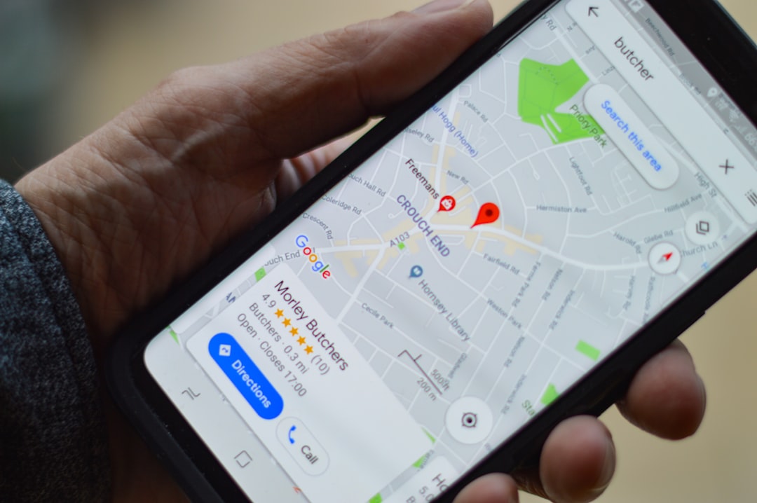
The first result on Google for "how to draw a radius on Google Maps" is a Stack Overflow thread from 2011. The top answer is "you can't." Fourteen years later, still true.
Google has never added native radius drawing to Google Maps. Not on the consumer web app, not on the mobile apps, not in Google My Maps. You can measure a straight line between two specific points, right-click, "Measure distance", but there is no tool that lets you plant a point and ask "what's within 10 miles of here?"
That feels wrong, because it's the kind of question half the population types into Google Maps every week. Plumbers mapping service areas. Real estate buyers wanting a 30-minute commute radius. Bar crawls. Delivery managers. Event planners trying to pick a venue within an hour of Austin. Everyone. The feature's absence is deliberate, and once you understand why, you also understand why the workarounds exist the way they do, and why a drive-time polygon usually beats a circle anyway.
Google Maps is a navigation product. It answers "how do I get from here to there," not "what's near here." That's a real architectural decision, not a gap.
Spatial analysis, "show me everything within a boundary", lives in other Google products. Google Earth has distance-measurement plus polygon drawing. The Google Maps JavaScript API (now called the Google Maps Platform) supports programmatic circles, polygons, and heatmaps. Google Business Profile lets a business define its service area by naming cities or dropping pins. Each of those serves a different audience: hobbyists, developers, and small-business owners respectively.
The consumer app has stayed focused on "get me there." Adding a radius tool would ship a feature that 2% of users want and 100% of users have to navigate around in the UI. That's a reasonable tradeoff, even if it's annoying when you're the 2%.
What this means in practice: everyone looking for a Google Maps radius ends up at one of four workarounds. Here they are, from least useful to most.
A handful of free sites draw a geometric circle on top of a Google Maps tile layer. Most-searched: MapDevelopers' Draw Circle tool, freemaptools.com, calcmaps.com. They work like this:
Five seconds, done. If all you need is a rough visual for a presentation slide, "our store, and roughly the 10-mile area around it", this is fine. Ship it, move on.
But the circle is lying about every practical question it touches. A 10-mile circle in Manhattan crosses the East River twice and includes parts of New Jersey the driver cannot reach without going to the George Washington Bridge or the Holland Tunnel. A 10-mile circle in suburban Atlanta stretches unchanged across I-285 in every direction, treating rush-hour traffic on the top-end perimeter as equivalent to free-flow conditions on a side street.
Two quick ways to notice the lying:
For a visual, fine. For a delivery zone, a service area, or a "what's my 30-minute commute" search, the circle will cost you.
mymaps.google.com is Google's custom-map builder, it's what schools use for field trip maps and what small nonprofits use for donor address pins. It supports:
What it does not support is drawing a circle by radius. You can approximate one by manually placing vertices, but that's 20 clicks for a rough hexagon that still isn't a real circle. The workaround most people use: generate a KML file from a circle-overlay tool, import it into My Maps as a layer.
Google My Maps also has an interesting ceiling: individual maps are capped at 10,000 placemarks total, and each layer at 2,000. If you're mapping more than a handful of delivery addresses or store locations, you hit the limit fast.
When My Maps is the right answer: you need to share a custom map with colleagues and embed it on a website, and the geographic overlay is mostly pins + hand-drawn routes. When it isn't: you need a real computed radius, drive-time or otherwise.
If you control code, the Google Maps JavaScript API supports google.maps.Circle natively:
javascriptconst circle = new google.maps.Circle({ center: { lat: 40.7128, lng: -74.0060 }, radius: 16093, // 10 miles, in meters map: map, fillColor: '#4285F4', fillOpacity: 0.2, strokeColor: '#4285F4', strokeWeight: 2 });
Seven lines. Renders a perfect circle. Works fine for a prototype.
The operational details are where this gets less fun. Running Google Maps Platform in production requires a Google Cloud billing account, an API key restricted by HTTP referrer, and a budget alert, because as of 2024, the platform charges $7 per 1,000 map loads (Maps JavaScript API) above the $200 monthly free credit. A website with 100k map loads a month, small by SaaS standards, runs about $500/month. Real companies regularly get billing surprises when an unexpected traffic spike pushes them past the free tier.
And the circle you get is still a geometric circle. Same limitation as Workaround 1, it draws on top of reality without consulting reality. Accurate drive-time modeling requires the Distance Matrix API or Routes API, which charges per origin-destination pair ($5 per 1,000 for Routes Advanced). Generating a 200-point isochrone requires 200 API calls, minimum.
If you're building a navigation product, the Maps Platform is worth the cost. If you're shipping a radius visualizer, it's expensive overhead for a circle.
Here's the reframe that makes Google's missing feature feel less like a problem: most people who search "how to draw a radius on Google Maps" don't actually want a circle. They want to know what's reachable. The circle is a bad proxy for that.
A driving radius map on RadiusMapper takes an address and a time budget (say, 15 minutes) and returns the irregular polygon representing where you can actually drive in that time. It bulges along highways, contracts in dense traffic grids, and honestly answers the underlying question.
Side-by-side on a typical query, "15-minute radius from a Cleveland pizzeria":
| Circle (3.5 miles) | Drive-time polygon (15 min) | |
|---|---|---|
| Shape | Geometric circle | Irregular, follows road network |
| Includes Lake Erie | Yes (half the circle is water) | No |
| Includes the I-90 corridor | Maybe (depends on radius) | Yes, stretched 4+ miles farther east along I-90 |
| Reflects dinner-rush traffic | No | Yes, if traffic-aware engine is on |
| Useful for delivery? | No | Yes |
| Useful for real estate commute search? | Barely | Yes |
Zillow figured this out and quietly ships a drive-time commute-radius filter powered by its own routing engine. Redfin added a similar feature in 2022. When billion-dollar consumer apps want to help users filter homes by commute, they don't show a circle, they show a drive-time polygon. That's the tell.
Use a circle-overlay tool when:
Use Google My Maps when:
Use the Google Maps Platform API when:
Use drive-time polygons when:
The reason people keep Googling "draw a radius on Google Maps" is that the underlying question comes up constantly in specific kinds of work. Each has a cleaner answer than a circle.
Restaurants, grocery stores, and florists need to define where they deliver. Chipotle's in-house delivery caps at roughly 8 minutes of drive time from kitchen. Sweetgreen uses 15. Uber Eats assigns delivery zones algorithmically per restaurant based on driver density. None of them use circles, they use drive-time polygons.
If you're setting up delivery, use a delivery area map that models round-trip drive time against driver capacity. Full playbook in our delivery zone planning guide.
A plumber in Dallas needs to know "can my tech get to this address in 40 minutes during rush?" A circle is useless, Dallas is a pile of highway interchanges where 5 miles can be 8 minutes or 38 depending on direction. A service area map with a drive-time polygon maps the actual service territory.
Home buyers looking for "everything within a 35-minute commute of my office at 9 AM on a Tuesday" don't want a circle. They want to see which neighborhoods actually sit inside that isochrone during rush hour. See our commute time map guide for the full workflow.
Google Ads and Meta both let you run campaigns keyed to a radius around an address. They default to a geometric circle because that's what the ad platforms internally index on. But if you're measuring the campaign's relationship to foot traffic, the foot traffic comes from the drive-time polygon, not the circle. Local marketing radius targeting covers how to reconcile the two.
Fire departments and EMS services target response times (usually 4-8 minutes for the first responder), not distances. The NFPA 1710 standard for career fire departments requires a 4-minute travel-time benchmark, that's time, not miles. ISO Class 1 fire protection ratings depend partially on whether populated areas fall inside documented drive-time isochrones from stations. A circle would be useless in this context; the whole regulatory structure runs on time-based polygons.
"Find me a venue within an hour's drive of Austin so team members in San Antonio and Waco can make it." A 50-mile circle around Austin includes parts of Hill Country that look close but are 90 minutes on winding farm-to-market roads. A 60-minute drive-time polygon bulges along I-35 and trims the Hill Country. Booking a venue based on the circle is how you get half your team stuck on FM 1431 for an extra hour.
Since Google Maps doesn't do this natively, here's the fast path.
Using RadiusMapper (free, no account):
You can share the result as a link, embed the interactive map on your own site, or export the boundary as GeoJSON if you're feeding it into your own GIS stack.
Using the Google Maps Platform (for developers):
You can approximate a drive-time polygon by calling the Distance Matrix API against a grid of points around your origin and interpolating a boundary. This costs real money, a 200-point grid at current pricing is about $1 per isochrone, and the result is still an approximation. Most developers who try this once switch to the RadiusMapper developer API or a dedicated isochrone service, because the purpose-built approach is faster and cheaper.
You can't, not in the consumer Google Maps app or Google My Maps. Three options: use a circle-overlay tool (MapDevelopers, freemaptools, calcmaps) for a quick visual, use the Google Maps JavaScript API if you're writing code, or use RadiusMapper for a drive-time polygon that actually reflects real road access. For most practical questions, the drive-time polygon is what you wanted anyway.
Only between two specific points. Right-click a location, select "Measure distance," click a second point, and Google shows you the crow-flies miles between them. It won't draw a circle of a fixed radius. Third-party overlay tools fill this gap on the consumer side; developers can use the Maps JavaScript API's Circle class.
A circle measures pure distance, equal in every direction, regardless of what's actually between you and the edge. A drive-time radius (also called an isochrone) measures reachable area within a time budget, accounting for roads, speed limits, one-way streets, and traffic. The circle ignores reality. The isochrone doesn't.
Yes. RadiusMapper is free, requires no account, and generates drive-time polygons instantly. It covers driving, walking, and cycling modes. For a visualization-only workflow where you want a circle on a Google basemap, MapDevelopers' Draw Circle tool is the fastest free option.
For delivery specifically, a geometric circle will produce a mis-calibrated delivery zone, you'll over-promise on the slow-to-reach side of the circle and under-serve the fast-to-reach side. Use a drive-time delivery area map instead. Enter your kitchen or store address, set your maximum delivery time in minutes (most restaurants use 15-25), and the polygon will reflect the actual reachable area. The full methodology is in our delivery zone planning guide.
The Google Maps JavaScript API supports embedded maps with custom overlays, including circles, but requires a Google Cloud billing account. Simpler and free: generate an iframe embed from RadiusMapper directly, paste it into your site's HTML, and the map renders without any Google Cloud setup. The full embed workflow is in our introducing RadiusMapper embeds post.
 RadiusMapper